Free Tofino Drone Flight Map — Know Where You Can and Can’t Fly Legally
Get your printable, easy-to-use Tofino aerial map with Canadian drone rules overlay, perfect for planning safe, legal flights.
Flying your drone in Tofino is breathtaking — but without knowing where you can and cannot fly legally, you risk fines or enforcement. This comprehensive Tofino Drone Flight Map shows restricted zones, controlled airspace, parks, beaches, and other areas with legal flight limitations based on Transport Canada regulations. Whether you’re a beginner or advanced pilot, this map helps you plan flights with confidence.
What You’ll Get
• A detailed Tofino drone flight map with legal zones clearly labelled
• Transport Canada airspace classifications relevant to Tofino
• Beaches, parks, and common “no-fly” areas
• Printable PDF and phone-friendly version
• Visual legends for safe decision-making
This map is created by professional drone pilots with Canadian flight rules in mind — not a generic DJI map export.
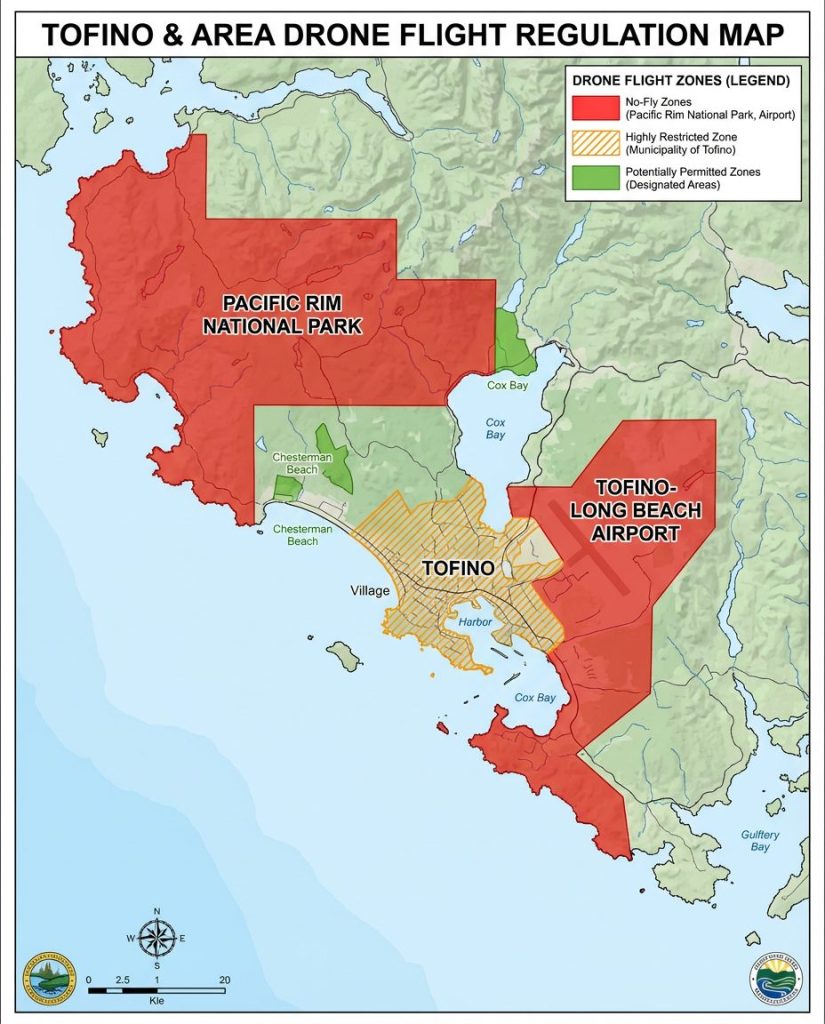
GET A FREE TOFINO DRONE MAP
A FREE indepth map of where you can and cannot fly your drone around Tofino, British Columbia